Overview
Maps
Stations
Gallery
Video
Yoshida Trail GPX-Datei-Download
(5th to 10th Stations)
The use of the data is only permitted for private use and is at your own risk. The data is for rough guidance only. No liability is accepted for errors or inaccuracies. Passing on to third parties or publishing the data is not permitted.
Explore more long-distance hikes in Europa
Find your perfect path or visit our trails page to discover more.
Mt. Fuji has four Trailheads and Ascending Trails
There are four trails that lead to the summit of Mt. Fuji. Each trail has its own trail head as the starting point.
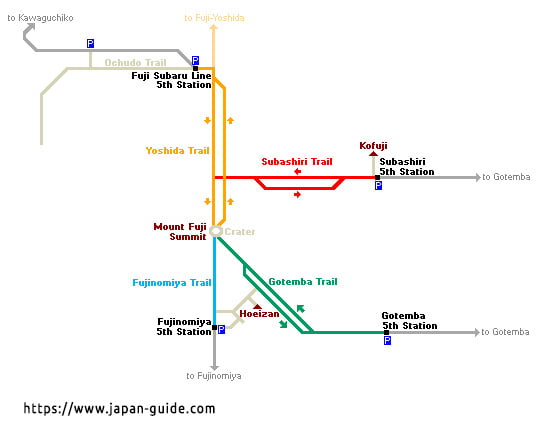
Fore more detailed information about the different Fuji mountain trails go to: https://www.fujisan-climb.jp/en/trails Thanks for providing me with this very usefull data.
Yoshida Trail 5th to 10th Station (ascent) in 2023
- th Station – Fuji-Subaru Line, 2300m
- th Station – Mt. Fuji Safety Guidance Center, 2390m
- th Station – 2800m
- th Station – 3300m
- th Station – 3500
- th Station/Summit – 3776m
The Yoshida Trail – Our Experience
Getting there
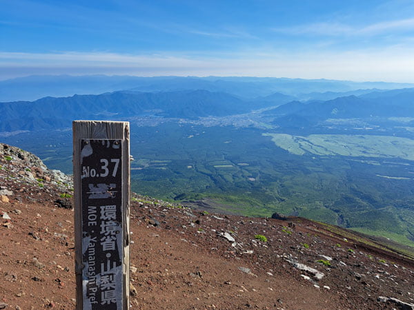
Mount Fuji, also known as Fuji-san, is the highest mountain in Japan at 3,776 meters. It is located in the Fuji-Hakone-Izu National Park and is therefore 100 kilometers west of Japan’s capital Tokyo. The journey from Tokyo to Kawaguchiko Station takes 3 hours on JR. From Shinjuku we took a JR regional train to Otsuki. A private train runs from here, which is not included in the JR pass and costs around 2,000 yen (16 euros) for a return trip to Kawaguchiko. From there, buses (Fuji-Subaru Line) run at least once an hour to the 5th station on Mount Fuji. These buses do not require reservations and cost 2300 yen round-trip. The bus stop is on the station forecourt. The town of Kawaguchiko offers shopping and overnight accommodation.
For purists there is the long climb
About 90 percent of the climbers start directly at the 5th station of the Fuji-Subaru Line at 2,300 meters above sea level. Depending on where the hiker is traveling from, there are other 5th stations. There are a total of four different hiking routes to the summit. Vehicles cannot reach higher than the 5th station. For purists, Fujiyoshida Sengen Shrine is the only true starting point for climbing Mount Fuji. From here you follow the 19 kilometer long climb on the holy mountain from the 1st to the 10th station at the summit.
5th – 6th Station
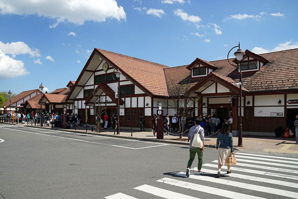
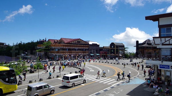
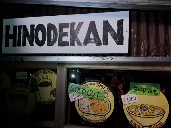
In the afternoon we reached this fifth station, which was busy with many tourists. Here you can find pretty much everything you need to stay overnight, eat and shop. After a plate of pasta we went to the lounge. There you will find a few tables and chairs and there are toilets next door. We waited here until 10:00 p.m. Batteries in the headlamps were well charged, water and snacks were stowed away and then we set off.
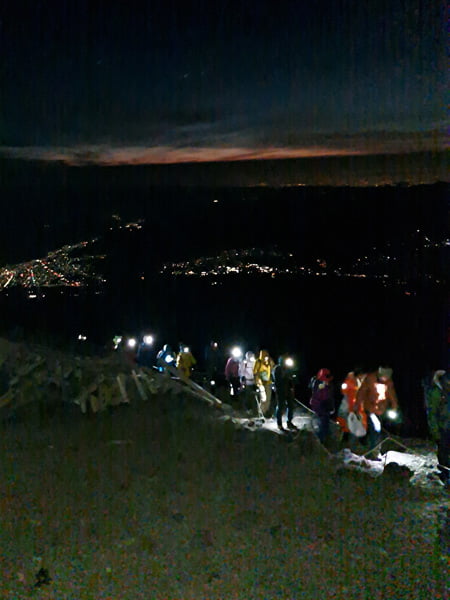
Of course we weren’t the only ones and so there are always a few hikers in front and behind you. The first section of the Yoshida Trail is flat, wide and forested before coming to the first fork at Izumigataki. The Yoshida Trail has yellow markings and is well signposted. From there, climbers can continue the climb or go to the fifth station, Yoshidaguchi. The crossing provides the first wonderful views of the valley, very impressive even at night.
6th – 7th Station
The path to the sixth station is steeper and leads through the tree line. As you approach the station you will see the Mt. Fuji Safety Guidance Center and from there the Yoshida Trail joins the Yoshidaguchi Trail, which starts down at the Kitaguchi-hongu Fuji Sengen Shrine.

The path zigzags for a while and reaches the seventh station at 2800 meters. The first huts are located here and there are numerous steep, rocky areas. Depending on the months and holidays, the number of night climbers trying to reach the summit in time can be high. This circumstance sometimes annoyed us because you only make progress very slowly. This can lead to hypothermia and loss of time.
7 th – 8 th Station
The Yoshida hiking trail between the 7th and 8th stations is basically no different. You cross a long section in rocky terrain. This area is not particularly demanding as there are no steeper passages and there are always enough climbing and grip options available. The 8th station is at around 3,300 meters. Because of this altitude, more and more mountaineers are taking short rest breaks. We made good progress and luckily had no problems with the altitude. The Yoshida Trail joins the Subashiri Trail at the original eighth station.
8th – 9 th Station
The path from the 8th to the 9th station is a well-developed hiking trail that winds upwards in serpentines. It takes about half an hour to get to the 9th station (3,400 meters), which is no longer in operation. A short time later you are at the last supply point below the summit. The 9.5. The station is located at 3,550 meters and offers the last place to rest protected from the wind. Because we got here too quickly, we stayed in a shelter in the cold for two hours. However, it is advisable to keep an eye on the number of climbers and not to do the last few meters too late. All night hikers have the same goal, they want to experience the sunrise.
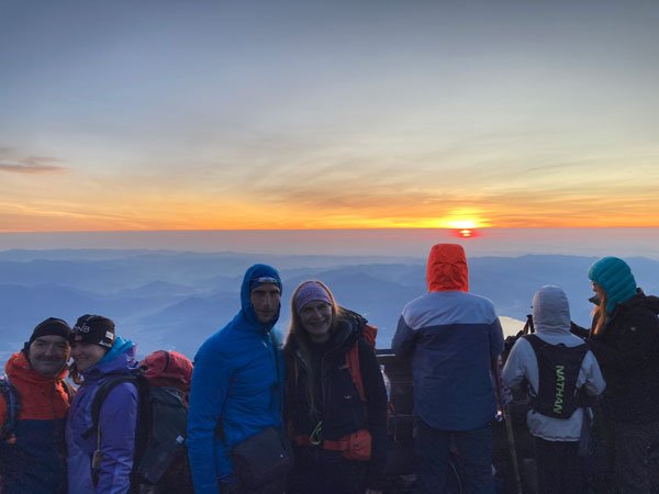
9th – 10th Station, summit
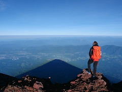
Once you have finally crossed the shrine gate just below the crater rim, it is only a few meters left and you are standing between huts, toilets and a few small shelters on the 3776m high summit of Mount Fuji and can enjoy the fantastic view from Japan’s highest mountain. A truly impressive experience. You can pick up a stamp at the summit. You can now walk around the crater to really take a selfie at the highest point.

Descent
The descent of the Yoshida hiking trail follows a different path than the one that leads to Mount Fuji. From the summit to the eighth station (Shita Edoya) it follows the same route as the Subashiri route. Since the descent takes place entirely over volcanic ash fields, this hiking trail is sometimes significantly more slippery than the ascent. This lava dust gets into every crack in your shoes. In addition, the wind can be even more unpleasant here as it can force the dust into your face.
Be careful not to miss the yellow signs marking the Yoshida hiking trail. This is often confused with the Subashiri Trail at the intersection near Shita Edoya. This happens to at least 1000 people every year! There are many mountain huts on the ascent, but there are no mountain huts on the descent side after the eighth station Shita Edoya. Additionally, there are no toilets on the descent to Seventh Station, so it is recommended to use the facilities at the summit. From the seventh station the path leads down to the sixth station. There are toilets here again. Then we continue to the fifth station of the Fuji-Subaru Line.