6 Tage
131 km
Moderate
7236 m
8730 m
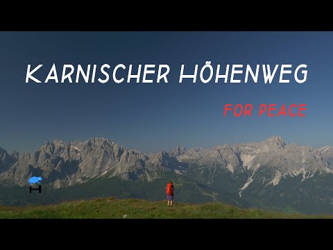
Carnic Peace Trail
A 7 day hike on the Peace Trail along the state border between Italy and Austria. A hike through the Hohe Tauern National Park.
Explore the Carnic Peace Trail in our video!
Are you looking for our detailed reports, stages or maps?
Carnic Peace Trail – Our Hiking Experience
| Orientation: red and white stripes as hiking signs with KHW 403. If you hike on the Italian side, the KHW 403 markings are missing. Nevertheless, the hiking trail is easy to identify. The Karnischer Höhenweg long-distance hiking trail is well marked on the Austrian side. | |
| The start and finish points are easy to reach by bus and train. You can also hike just a few stages and get off | |
| You should be in good physical shape. This path brings you many vertical meters on uneven terrain. Technical climbing skills are not required. | |
| In most mountain huts you can pay with your credit card. Nevertheless, it is very advisable to carry cash with you, as machines sometimes fail. | |
| During your hike you will reach huts that are managed several times a day. There are very delicious offers here! Take enough water with you from the huts. There are hardly any streams or rivers with potable water. Due to the cattle farming, the water in the alpine pastures is not recommended. | |
| The Carnic High Trail is a pure hut hike. Camping in the mountains of Austria and Italy is prohibited. You should reserve the huts early, especially in summer. Membership in an alpine club is strongly recommended. | |
| Along the Friedensweg you will find numerous objects such as ruins that are reminiscent of the terrible wartime. The entire length of the hiking trail runs through a varied mountain landscape and offers wonderful views and panoramas. | |
| Pay attention to compliance with the rules when dealing with grazing animals. Here is a flyer download from the Federal Ministry of Agriculture, Regions and Tourism (BMLRT) – Austria |
Our stages
1. Sillianer Hütte to Porzehütte, 20km
2 Porzehütte to Hochweißsteinhaus, 17km
3. Hochweißsteinhaus to Wolayersee-Hütte, 15km
4. Wolayersee-Hütte to Zollerseehütte, 23km
5. Zollerseehütte to Alpenhof Plattner, 24km
6. Alpenhof Plattner to Gasthaus Starhand, 23km
7. Dolinza Alm to St.Stefan Vorderberg (station), 8km
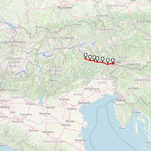
The Carnic High Trail or KHW 403 is one of the most beautiful long-distance hiking trails in Europe. The path is also part of the E10 European long-distance hiking trail. This long-distance hiking trail KHW 403 is around 150 km long and leads through a varied landscape. During the First World War, the front between Italy and Austria ran along the crest of the Carnic Alps. The traces of this mountain war are visible along the long-distance hiking trail.
Carnic Peace Trail – „Via della pace“
This is why this trail is also called “Via della Pace” or the Carnic Peace Trail. The KHW 403 is a long, inner-Italian high-altitude trail along the former Italian-Austrian frontline of the First World War in the Alps.
Awesome landscape
Those who want to hike half of the KHW 403 will find two different sections. The western part is high alpine from Sillian to the mountaineering village of Mauthen. The eastern part shows itself more from its gentle side. Here you hike across extensive alpine pastures to Thörl Maglern.
For more information about the hiking trip Carnic Peace Trail don´t hesitate to contact us. Feel free to watch our videos on YouTube and explore our other trails we´ve experienced for you!
Take care and go out and make it happen!