4 Days
85 km
Moderate
2437 m
2260 m
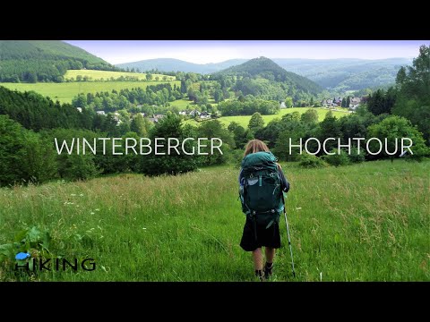
The Winterberger Hochtour Trail
A 4 days round hike from the city Winterberg through the Nature Park Rothaargebirge. You conquer four “eight hundred” mountains.
Explore the Winterberger Hochtour Trail in our video!
Are you looking for our detailed hiking report, stages or maps?
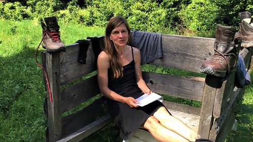
Winterberger Hochtour Trail – Our Hiking Experience
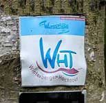
| The Trail is well marked with the logo or a “WHT” (Winterberger Hochtour). | |
| The city of Winterberg is easy to reach, whether by bus, train or car. There is free parking. | |
| You should be in good physical shape for the 85 km. On the Winterberger Hochtour you cross several mountains with over 700 m. The Kahler Asten (840m) is the highest point. Technical skills are not required. | |
| You should also take cash with you on this tour. You won’t need a lot of money, depending where you stay. | |
| The path leads you along numerous refreshment stops and villages. | |
| We cannot provide any information about pensions or hotels at this point. We spent the three nights in a tent. As always, the exact locations can be found on our maps. It should be expressly pointed out that camping in protected areas is prohibited. It is important to us: We leave the bivouac as we found it! | |
| Numerous gems and places steeped in history lie along the way. The Rothaargebirge is dominated by spruce forest. Due to the persistent drought, many forest areas have died | |
| There are no special safety instructions for the Winterberger Hochtour Trail. In the winter months there may be stronger snow conditions. |
Stages we hiked
1. Winterberg to Niedersfeld, 25 km
2. Niedersfeld to Züschen/Wernsdorf,30 km
3. Züschen/Wernsdorf to Langewiese, 20km
4. Langewiese to Winterberg, 10km

The Winterberger Hochtour with a distance of 85 km explores the area around Winterberg as a circular route. You should be in good physical condition to tackle the highest peaks (843 m) in the Sauerland. The Winterberger Hochtour begins and ends on the Kahler Asten in North Rhine-Westphalia or the city of Winterberg. In between, it crosses the highest peaks of the Upper Sauerland, crosses valleys and absorbs cultural highlights and untouched nature.
“Quality Trail Wanderbares Germany”
Hikers can explore the source of the Lenne and North Rhine-Westphalia’s most extensive mountain heath in the Neuer Hagen nature reserve. Part of the Winterberger Hochtourweg leads along the Rothaar and past the mountain villages of Langewiese, Neuastenberg and Lenneplätze. The Winterberger Hochtour has been awarded the “Quality Trail Wanderbares Germany” seal of approval by the German Hiking Association (DWV).
Für weitere Informationen zum Wanderweg Winterberger Hochtour zögere daher nicht uns zu kontaktieren. Schaue dir unsere Videos auf YouTube an und erkunde unsere anderen Trails, die wir für dich erlebt haben!
Pass auf dich auf und geh raus und mach es möglich!