7 Days
128 km
Moderate
3209 m
3240 m
The Isle of Skye Trail
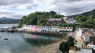
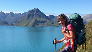
A wonderful 7 day tour of the Scottish Highlands. The route follows the Trotternish Ridge, the Black and Red Cuillin as well as coastal cliffs .
Explore the Skye Trail in our video!
Are you looking for our detailed hiking report, stages or maps?
The Skye Trail – Our Hiking Experience
| Since this long-distance trail is not official trail markers are missing. Most sections show a path. Sometimes a good sense of direction is very helpful. Beware of poor visibility! Map material is very helpful for this hike. We usually use print outs for each section. This is much more practical in the terrain and cost nothing. | |
| Inverness or Fort William are good entry points. From there to Isle of Skye and Broadfort isn´t a big deal. A bit more tricky can be the exit or start point Rubha Hunish. Look for the bus stop near the castle ruins. | |
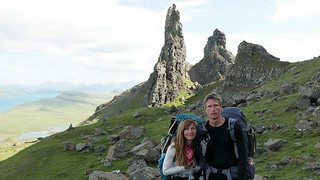
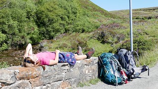
| We managed the Skye Trail during eight days. The weather was brilliant and so the tour was incredibly enjoyable. Respect for those who go through this during a week of constant rain! Sky, water and mountains were equally present along the trail. | |
| Cash as well as credit card are possible in many places. | |
| On the hike you will pass some refreshment stops. On some stages you should have your own food with you, as there are no alternatives. | |
| On this tour we can recommend some accommodations. The Broadfort Backpacker, Pier Hotel in Portree and Flodigarry Hostel. Otherwise camping wasn’t a problem. You should use a rainproof and stormproof tent. | |
| Overall, the Skye Trail is a fantastic long distance trail with almost 130 km in length. It shows a cross section of the Scottish highlands. We enjoyed it very much! | |
| For long distances there´re no waymarks nor a path! We as well as other hikers experienced one dangerous spot behind the “Old man of Storr”. Following the correct path you have to go over the rigde and not going straight on what we did! The big concern about rain and midges is justified, but as always also a matter of luck. Hope for the best and plan for the worst! |
Stages we hiked
1. Broadford to Torrin, 23 km
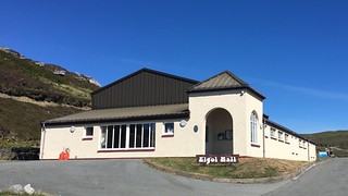
2. Torrin (via Elgol) to Camasunary Bothy, 20 km
3. Camasunary Bothy (via Sligachan) to Balmeanach, 19 km
4. Balmeanach to Portree, 15 km
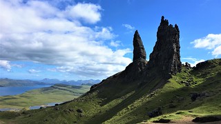
5. Portree to The Old Man of Storr, 16 km
6. The Old Man of Storr to Floigarry, 24 km
7. Flodigarry to Rubha Hunish, 11 km


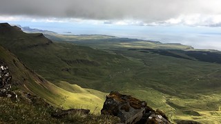
The Skye Trail is a demanding, unofficial 128 km long distance walk. The trail covers most of the length of Isle of Skye, passing through tough terrain including spectacular mountain and coastal scenery. The route follows the Trotternish Ridge, the Black and Red Cuillin as well as coastal cliffs and steep slopes of the highland mountains.
Be aware that the Skye Trail is an unofficial route. For long distances there´re no waymarks nor a path! Thinking about scottish weather in the highlands you have to be prepared of being able to navigate. This walk is adressed to those who´re experienced in hiking or trekking. For many sections there are no exit routes.
We as well as other hikers experienced one dangerous spot behind the “Old man of Storr”. Following the correct path you have to go over the rigde and not going straight on what we did! So we nearly ended up in a suiced mission crossing a step slope of gravel above high cliffs. As you realised we made it – luckely.
For more information about the hiking trip on the Isle of Skye Trail don´t hesitate to contact us. Feel free to watch our videos on YouTube and explore our other trails we´ve experienced for you!
Take care and go out and make it happen!


