Total climbing: 6202 m
Total descent: -6465 m
Iceland Traverse GPX-File-Download
(with all overnight stays)
The use of the data is only permitted for private use and is at your own risk. The data is for rough guidance only. No liability is accepted for errors or inaccuracies. Passing on to third parties or publishing the data is not permitted.
Overview
Iceland traverse route map, July/August 2022
- Reykjahlid – Myvatn, 11km, 1b. Myvatn – River, 25km
- River- Dungjufell hut, 32km
- Dungjufell hut – stone desert, 27km
- stone desert – Kistufell ermergancy hut, 25km
- Kistufell ermergancy hut – river, 32km
- river – Nyidalur hut, 25km
- Nyidalur hut – River, 28km
- River – Pony Farm, 27km
- Pony Farm – Lake Porisvatn, 34km
- Lake Porisvatn – Bder Fjallabak Nature Reserve, 29km
- Border Fjallabak Nature Reserve – Landmannalaugar, 15km
- Landmannalaugar – Alftavatn, 21km
- Alftavatn – Pörsmörk, 31km
- Pörsmörk – Skogar, 24km
Our stages!
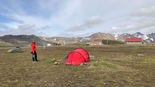
1a. Reykjahlid – Mývatn, 11km 1b. Mývatn – River, 25km
Hiking through Iceland with a suitable route and map has been our plan for a long time. Our orientation was mainly based on our gpx map. After months of preparation, the start was at 8:00 a.m. in Akureyri. By bus no.56, the price for a ticket 5000 ISK, an hour later arrival at Mývatn south bank. It may happen that the bus driver does not stop and continues to Reykjahlid. In this case you can then hike south on the east side of the lake. For reasons of time, we wanted to save ourselves that.
The adventure of crossing Iceland from north to south begins
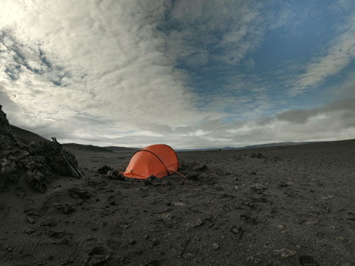
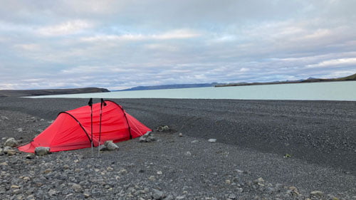
Who would have thought, we’re walking across Iceland. The route was clearly visible at first, could clearly see the course of the lonely highland track, through a desert of black sand and lava slabs. It quickly became clear that there is little water here, actually no water at all. After 17km we reached a river. Fresh weather with light rain, north/west wind. It was very pleasant and there are no vertical meters on this stage.
2. River- Dyngjufell Hut, 32km
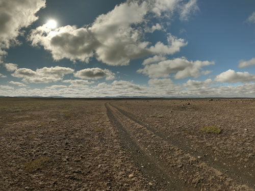
Long ways to the horizon and beyond. We hiked through Iceland, a good route and map give us security! Infinitely many kilometers to the south. How beautiful this calm was. Here you can understand what the word calm really means. This remoteness is mystical, no other hikers, no vegetation, no birdsong. On sight, the paths are mostly recognizable. We passed the turnoff to Botni Hut but stayed on our route. Had good weather conditions, there was only the plain but without any shelter! It was so quiet and the solitude in which we moved was indescribable.
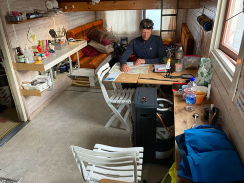
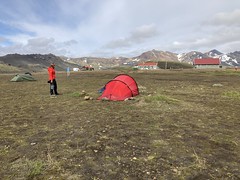
Finally around 7.30pm we reached the Dyngjufell hut, all very comfortable (heating/toilet) 5500 ISK pp or 500 ISK for a tent. Trusted payment – money is left in a cassette. We have read that the hut can also be booked online. In dry times this hut can be a life saver. There is an emergency canister with water in the hut. Very important to remember to always stock up on water supplies. We were lucky, because there was also enough meltwater in the river at the time.
3. Dyngjufell Hut – Stone desert, 28km
We had a leisurely breakfast in the hut. From here you can also go to Askia (extra day). But we didn’t do that because of the weather, because the forecast was rather cloudy and rainy. A long day of hiking through rugged mountains awaited us, with jet-black basalt everywhere in a barren highland desert. You can always see the imposing glaciers on the horizon. This creates a nice contrast to the otherwise black-grey landscape. All this is impressive, but don’t forget to schedule the water.
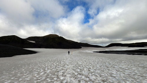
4. Stone desert – Kistufell emergency hut, 25km
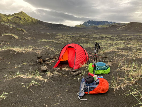
This bizarre black desert landscape with imposing lava sculptures accompanies us further, loneliness and silence in these endless glacial valleys. The highlands are an unreal place, mosses and lichens try to assert themselves in the barren landscape and offer our eyes a welcome change. The center of the island is the wildest area in the country. In this highland there are almost no settlements and no signs of civilization. At this point, it is once again a reminder to have a safe route and map with you if your goal is to hike through Iceland. We reached the Kistufell emergency hut in the late afternoon. Everything is very reduced here, colorful warm wool blankets and a beautiful sun terrace in this lonely region, almost a luxury. We didn’t see anyone else on this stage, so we had the hut to ourselves. We enjoyed the view into the distance and looked back to where we came from.
Beware of storms

Caution: There may be water shortages between Dyngjufell and Nyidalur. Behind the Kistufell hut there is mostly old snow (water) even in summer, but not always! We have also heard reports that there can also be very strong sandstorms in this area. In the flat, dry plains, the sharp-edged volcanic sand is then driven through the air. This can be very painful for the eyes. In addition, the countless river courses on the lower levels, which are often dried up, can be impassable due to ice melt or heavy rain.
5. Kistufell emergancy shelter – river, 32km
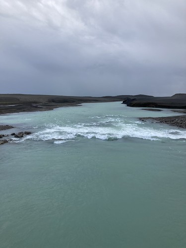
Along the lonely highland track full of fords we always hiked straight down south. We didn’t meet anyone, just old footprints in the black sand. These led across the uninhabited interior of Iceland. Here, too, we walked through a surreal lunar landscape, like “Mordor in Middle-earth”. After about 20km on the plateau we passed a private hut, which was locked. Here we were finally able to supply ourselves with water again. The goal for the day was to make it to the next bridge. These hours along the gravel route hardly went by at all. The first jeeps came towards us. Finally arrived on the F910, we hiked to the river Skjálfandafljót and found a very nice place for our tent nearby. As always to be found on our route or map of our Iceland hike.
6. River – Nyidalur Hut, 25km
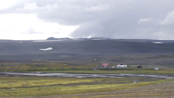
Also on this day a long, impressive hike through the Icelandic highlands, over dusty gravel paths, with little variety and some river crossings. The big rivers can only be crossed over bridges, therefore our route often follows one of the F-roads to cross the big streams. The Vatnajökull glacier massif could be seen in the distance. Again and again the feeling of untouched wilderness. The Nýjadalsá flows through the next valley, a not to be underestimated project to cross this river, but then you have reached the cottage Nyidalur. Costs 2500 ISK pp for camping, 500 ISK pp for a hot shower and 500 ISK pp for using the kitchen. You can’t buy groceries here, but a few snacks are also a great treat.
Meeting Point Nyidalur Hut
This is the place where many travelers meet. Whether cyclists, hikers or off-road lovers. There is also a ranger station in Nyidalur, which provides up-to-date information on weather and road conditions. If you are planning a crossing of Iceland, you should mark this point in your route and on your map.
7. Nyidalur Hut – River, 28km
We had a pretty stormy night in the tent, but the morning brought sunshine, only the wind didn’t want to stop and blew a lot around our ears. From the hut we first continued on the slope, following the lanes in a southerly direction. Lonely yellow posts marked our trail. Basically, orientation on such sections is not difficult, you always follow the gravel road. A never-ending route for kilometers, but we always had the mountain ranges in view, here too we had to cross a few fords.
River crossings
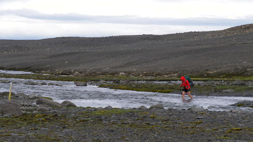
There are many hints on how to cross the rivers in Iceland in the internet and in books. Often not a problem for 4 X 4 jeeps, it is very different for hikers. The current can be very strong, as can the cold. There are hikers who wait across the river at night, because then a lot of water is bound in the ice. In the morning the level rises again. We were lucky with our route and could always pass. Hiking poles can be of great help here. Nevertheless, never underestimate the glacial rivers!
8. River – Pony Farm, 27km
Bad weather conditions, constant wind around us. In the middle of nowhere and far away, nothing, not a forest, not a single tree. The landscape here was very monotonous, but no less spectacular. It seemed like the world had run out of color. Glacial moraines shaped this landscape and the wind whipped up the rock of sand and gravel beneath our feet with every step. A day of silence.

9. Pony Farm – Lake Pórisvatn, 34km
The unreality of the barren landscape requires mental strength and is depressing. Especially when there is no sun, the horizon is overcast, it looks like rain, but it hasn’t rained. Far and wide not a soul. Lonely paths, but not without a path, we moved through the highlands. We marched along the Jeep track F26. From time to time we stand in amazement at what the rough forces of the earth have created: desolate rocky deserts, rugged peaks, endless lava fields and always on the horizon the ice-covered glaciers. Today’s goal is to reach the Pórisvatn reservoir. We often leave the F-piste and go cross-country as the crow flies until we hit the gravel road again.
10. Lake Pórisvatn – Border Fjallabak Nature Reserve, 29km
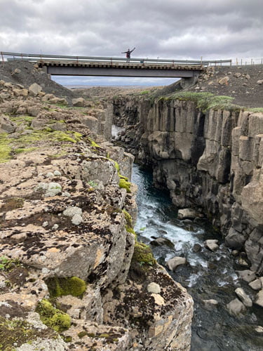
Another seemingly endless day, mystical, bizarre and still with this silence. A few bushes, ground cover, grasses show up along the path over slight hills. Then civilization and abruptly a road, the route leads between two reservoirs. Imposing mixed water colors from Hrauneyjalón, we have seen from the bridge. The asphalted section ended behind the bridge, followed by an ascent. Once at the top you have a beautiful view over the area, from here we followed the power poles. At one point you get close to the Tungnaá. Loud and mighty, the masses of water whirl. We don’t make it to Landmannalaugar that day, cross the valley as far south as possible and look for a place to stay late in the evening. The border to the Fjallabak Nature Reserve can be seen on the map or the GPX track of our Iceland crossing. Here we pitched our camp somewhat hidden.
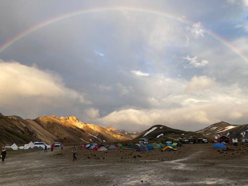
11. Border Fjallabak Nature Reserve – Landmannalaugar, 15km
The path runs parallel to the river bed, through a lava field, the colors have changed from gray to green. Arrived at Camp Landmannalaugar in the morning, we rent a bed camp and took a break. At the campsite there are dozens of colorful tents on the rubble floor, several picnic areas, a tourist information center and a wash house.
First we walked through the cotton grass meadows to the hot springs that gives Landmannalaugar its name. Depending on the distance from the source, the temperature of the water is between 20 and 40°C. We can really recommend swimming in this hotspot pool of the green oasis, even when it rains. Here civilization has caught up with us again. A little off there are 2 old American school buses that provided us with the most necessary groceries. Washed, rested and full, we looked forward to the last stages of our route in a relaxed manner.
12. Landmannalaugar – Álftavatn, 21km
The colorful mountains of Landmannalaugar glowed red, yellow, green, and blue. An impressive place is this colorful geothermal area. Yellow sulfur fields and hissing springs, steam rising from every corner of the valley, a great atmosphere. You just can’t get enough of looking at it. Fire and ice, wind and water form this fascinating landscape, bubbling burrows, beautifully colored mountains, sulfur deposits, colorful limestone deposits, it hisses and bubbles everywhere.
Landmannalaugar Hiking Trail
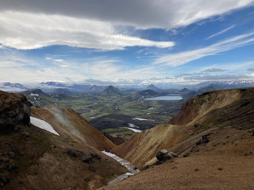
The signpost for the Laugarvegur, the famous trekking route, is also our final route. The trail leads from Landmannalaugar to Thórsmörk. Many hikers run the 55 kilometers in four days. The first sub-goal of the day is the Hrafntinnusker hut, these kilometers were more strenuous than expected due to a very long easy climb through slushy snow. But then the Hrafntinnusker hut, sunken in the snow, appeared behind a hill. We get a sheltered place on the terrace to rest. Unfortunately, the huts on Laugavegur may only be used by guests who are also staying there. Rested and strengthened, we continued our trekking towards Álftavatn. We followed the tracks, over snow bridges through the imposing snow-covered basin. The view at the top is overwhelming. Once at the bottom, a river has to be crossed to reach the campsite. A few other hikers had already pitched their tents here at the lake. Really nice place.
13. Álftavatn – Pórsmörk, 31km
The Álftavatn hut with associated campsite is idyllically situated on Lake Altavatn. As with all huts, the equipment is very simple. The Laugavegur trail now turns out to be much easier. After a few kilometers we reached the first of three rivers. We had a lot of respect, the ford turns out to be easier and easier due to our experience and barefoot shoes. From here we continued through a beautiful lava desert surrounded by green, partly snow-capped mountains. Around 12:30 p.m. we reached the Emstrur hut. Took a break and made it to Pórsmörk that day. Arrived in Pórsmörk, the campsite with shop, communal kitchen and toilet block invites you to linger.

14. Pórsmörk – Skógar, 24km
Our last tour started in the densely forested valley of Þórsmörk through a fascinating mountain landscape over the 1100 meter high pass of Fimmvörðuháls. After the steep climb, the trail led through the volcanic lunar landscape between the Eyjafjallajökull and Mýrdalsjökull glaciers. Up here on the plateau in the middle of the old snow fields and strong winds we got an impression of the forces of nature. Caution: It can get extremely cold very quickly! Heavy fog can also set in! A moment ago it was still storming and the next moment the sun was shining and suddenly you could see the Atlantic in the distance.
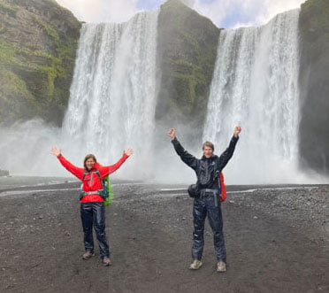
Waterfall Skógafoss
After the pass, the landscape has changed. Pass deep gorges and 26 waterfalls, each more beautiful than the last. Fairytale waterfalls, the rushing of the water is incredibly soothing in this graceful landscape. Lush green hills where sheep graze the meadows, the last 10 km along the Skógar River. At Skógafoss, a spectacular 62m high water curtain, our approx. 400 km scenically impressive tour ended. Hiking the Iceland traverse is a unique adventure if you have the right route and map with you.
We are very happy and grateful to have managed the hike through Iceland after 14 hiking days and about 400 kilometers unharmed. Grateful for all the help, nice encounters and exciting experiences.
For more information about our Iceland traverse route map do not hesitate to contact us. Watch our videos on YouTube and explore our other trails we have experienced for you! Take care and go out and make it happen!