10 Das
177 km
moderate/hard
10453 m
9911 m

The Transcaucasian Trail Georgia- Hiking in the Greater Caucasus
Our 10-day trekking tour in Georgia. An unforgettable adventure along the main ridge of the Caucasus in Svaneti.
The Greater Caucasus – A mountain range full of adventure
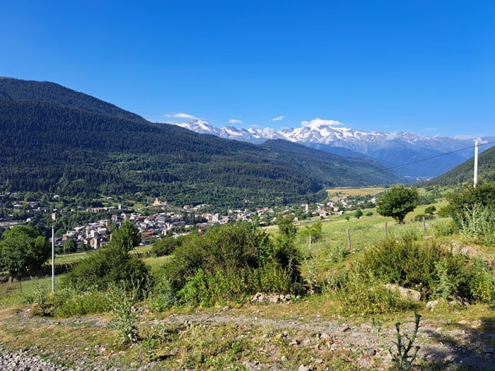
The Greater Caucasus, a vast mountain range that stretches from the Black Sea to the Caspian Sea, is a paradise for mountain enthusiasts. With its snow-capped peaks, deep valleys and untouched natural landscapes, it offers a backdrop that is second to none. The Svaneti region in northwest Georgia in particular has established itself as an El Dorado for long-distance hikers.
Hiking in the Greater Caucasus – An unforgettable experience
A hike in the Greater Caucasus is more than just physical exertion. It is a journey into another world, characterized by silence, solitude and the overwhelming beauty of nature. The hiking trails are often challenging and require surefootedness and fitness. You will be rewarded with breathtaking views, an unforgettable encounter with the local culture and the feeling of experiencing the wilderness in its purest form. The hikes often lead through alpine landscapes, past gurgling streams, over green alpine meadows and through rugged rock faces.
The Transcaucasian Trail – A challenge in a class of its own
The Transcaucasian Trail Georgia, an ambitious project that aims to create a continuous hiking trail through the entire Caucasus. Once completed, a network of more than 3,000 kilometers of hiking trails will offer hikers the unique opportunity to explore both the Greater and Lesser Caucasus, crossing Armenia and Georgia. The section through Svaneti in Georgia is considered one of the most spectacular and challenging. Hikers can spend days here wandering through untouched nature, crossing high alpine passes and immersing themselves deeply in the local culture.
The Ushba: Matterhorn of the Caucasus
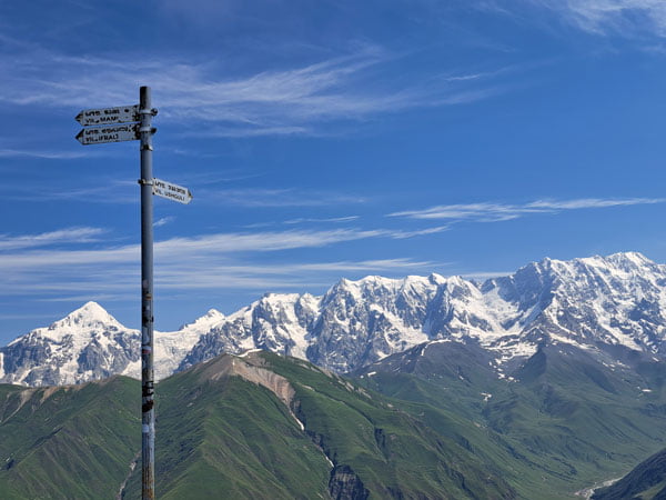
The mountains of Svaneti are characterized by mighty peaks such as the Ushba (4,710 m), one of the most beautiful and dangerous mountains in the Caucasus, and the Shkhara (5,193 m), the highest mountain in Georgia.
FAQ about the Transcaucasian Trail in Georgia
Hiking in Svaneti, Georgia – The Transcaucasian Trail
Discover more on YouTube @hikingexperience
Hiking trails – Transcaucasian Trail in Georgia
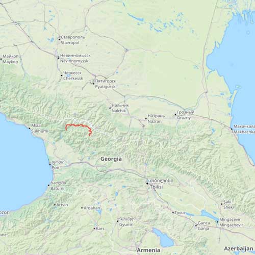
On a 140-kilometer-long stage of the Transcaucasian Trail, the official route leads through the mountain passes, alpine meadows and villages of Upper Svaneti in northwest Georgia. The hike starts in Chuberi, a village group in the Nenskra Valley, and ends in the highest village in Svaneti, Ushguli. We have extended this section by a few kilometers.
- Trail markings: The trail is mostly marked with red-white or yellow-white markings.

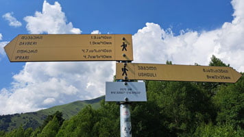
- Direction signs: Yellow direction signs with information on distance and walking time guide you safely along the path.
Transcaucasian Trail Georgia| Our tour guide about the 9 stages in 2024
177 km along the Greater Caucasus in Georgia.
Starting location: Chvelpi (in the east)
Destination: Khaishi (in the west)
FAQ – Transcaucasian Trail Georgia – Our experiences
| The Transcaucasian Trail takes you close to the main ridge of the Caucasus. We have extended the official long-distance hiking trail to a 177 km long mountain hiking trail with our own route. You can find detailed information about the route for our tour under Stages. You do not need any special permits for this section. | |
| The journey is usually made from Tbilisi, the capital of Georgia, by minibus (marshrutka) to Kutaisi and then by local taxi or hitchhiking to Chvelpi. Many hikers only want to walk the Mestia-Ushguli route. Therefore, Mestia is the stronghold for all hiking tourists. Many minibuses run from here in all directions. Departure from Khaishi in the west is similar. You ask locals about the next travel option. They are usually helpful. | |
| The 177 km can be strenuous due to the often steep route or the sun. The altitude (1500-3000m) and heat can put a lot of strain on the circulatory system, so it is essential to drink enough fluids. We always found good water at higher altitudes. Logically, you should avoid water near cattle and horse pastures! | |
| On this tour you should definitely have enough cash in small bills. Card payments are only possible in Mestia. | |
| These hikes in the Greater Caucasus take you through a small settlement every day. You sometimes have to ask for meals or a coffee, as not everything is always signposted. This is also a good opportunity to get fresh water and try the regional delicacies. | |
| You can find more information about specific accommodations in our detailed report! As always, you can find the exact locations on our maps. There are numerous private accommodations along the route. Since we absolutely wanted to be independent and the tour included overnight stays in the mountains, we brought our tent with us. You could also do this hike completely without a tent. | |
| The Transcaucasian Trail Georgia is a long-distance hiking trail in alpine terrain. Although the route does not lead over scree or rocks, it is more characteristic of the high alpine pastures and wild flowers up to 3000 m altitude. We only saw a few horses at high altitudes. The route is quite steep in places and you gain up to 10,000 meters in altitude! There are a few providers of guided tours (Mestia-Ushguli). Tours with luggage transport can also be booked. We met a few hikers who used this service. | |
| Technically, this route is not difficult. The long-distance hiking trail requires fitness and stamina. At Adishi, you have to cross a glacier river. The Adishi glacier releases a lot of meltwater here. Depending on the melting and rain, this can be a very difficult undertaking, as the current can be very strong. Don’t underestimate it! The good thing: There are often locals with horses at this point. Heat can also be very stressful. There is no drinking water on longer sections! |
Explore more hikes
What are you waiting for? Get your hiking boots on and let’s go!


Stefan & Claudia
For more information about HikingExperience do not hesitate to contact us.


