Total climbing: 6015 m
Total descent: -6068 m
More information in our map Kungsleden Trial.
Go back to parent page for our summary.
Stage report of our tour Kungsleden Trail, July 2019
1. Abisko to Abiskojaure, 13 km
2. Abiskojaure to Alesjaure, 22 km
3. Alesjaure to Sälka, 23 km
4. Sälka to Teusajaure, 29 km
5. Teusajaure to Saltoluokta, 14 km
6. Saltoluokta to Skierffe (1179m), 36 km
7. Skierffe to Fjällstation Jägge, 20 km
8. Jäggehütte to Kvikkjokk, 26 km
9. Kvikkjokk to Tsielekjakk hut, 15 km
10. Tsielekjakk hut to Tjäurakatan, 30 km
11. Tjäurakatan to Hostel Vuonatjviken, 22 km
12. Vuonatjviken to Jakkvikk, 23 km
Read our story!
1. Abisko to Abiskojaure (camping beside the path) 13km
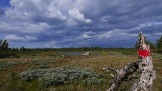
By plane from Amsterdam and a stopover in Stockholm we traveled to the Swedish Lapland, geographically the Arctic Circle. Arrival at 5:30pm at the airport Kiruna. Unfortunately, there was no bus left for Abisko this Friday. Our starting point for the Kungsleden. With a friendly taxi driver and a stopover in an outdoor shop and supermarket in Kiruna, we were fully equipped. We continued our drive towards Fjällstation Abisko. 2000 SEK (200 EUR) was a lot of fun for that ride, but it was well worth it. So finally we started the Kungsleden trail at 7:30pm. There were still 14 km of walk on this beautiful evening. We followed a wide, well-trodden path into the rather dense Fjällforest. The terrain was largely dry, but some sections led us through wetlands and had to be crossed on planks. Continuing in a southerly direction, over suspension bridges with the rushing of the water masses of some rapids of the river Kamajakka, we continued along the Kungsleden with a slight rise. The birch forest became less dense and we were still here in the Abisko National Park. Past the lake Abiskojärvi, we have been in the middle of the Swedish nature experience. A long day and we found the first nice place for our tent at 10pm. Late in the evening and still so bright, summer solstice in Sweden.
2. Abiskojaure to Alesjaure (camping beside a suspension bridge) 22km
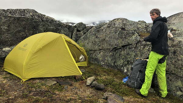
With our usefull sleep masks we rested until 10:00am. Our night camp was 3km after the Abiskojaure hut at the sign Bredskapminne, a defense system from the 2nd world war. About 1km after the national park border we crossed the thunderous mountain river Siellajohka at dizzy heights. Then, after a long climb on the King´s Trail, the treeless high mountain massif spread in front of us in all its splendor. Past the pastures of the reindeer herds, we walked comfortably through an impressive panorama. Unfortunately the weather was rainy!
In the afternoon we reached the shore of the lake Alisjärvi. A lake which you can get around in two different ways. We hiked the Kungsleden trail to the Alesjaure hut, along the west bank. We did not use the faster transport by motorboat. It was still raining and we had a long break at the Alesjaure mountain hut. After this recovery with a hot drink, we went on while the weather changed. The resting place near the suspension bridge over the river Bossusjakka was the right place for our second night in our tent. The glacial river rushed in our ears all day long.
3. Alesjaure to Sälka (camping beside a suspension bridge) 23km
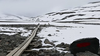
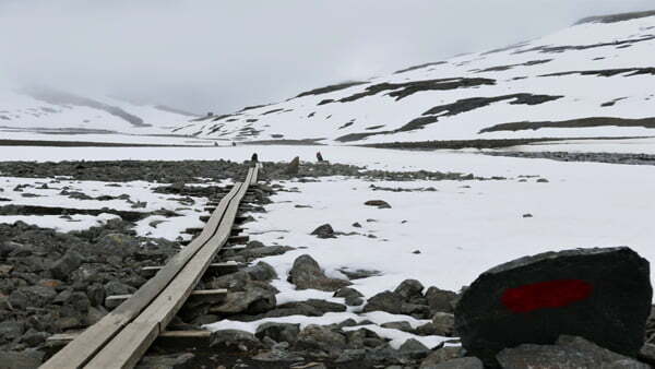
The next morning the Kungsleden led us steadily uphill over a long heath, which was easy to hike through the boardwalks. The broad valley is framed by high peaks. We continued crossing tributaries for several kilometers of hiking and before climbing towards Tjäktjapass, we barefooted through the ice-cold water with our barefoot shoes. The Kungsleden climbs here over vast gravel fields to its highest point (1.150m). The weather was better, but the rain of recent days had left its marks, the old snowfields also made it difficult to get ahead. After the climb, we took a break in the shelter to rest and eat, at the top of the Tjäktjapass. The descent was steep and slippery for the first few kilometers on the Kungsleden. All efforts became quickly forgotten, because the path now ran through a moor into a beautiful valley. Following the Kungsleden trail came to an end of the stage Sälka huts, a place to stay. We equipped ourselfs with sweets in the small shop and had still 3km to hike to the suspension bridge. We set up our tent on the riverbank and slept very well after this stage.
4. Sälka to Teusajaure (camping before the station) 29km
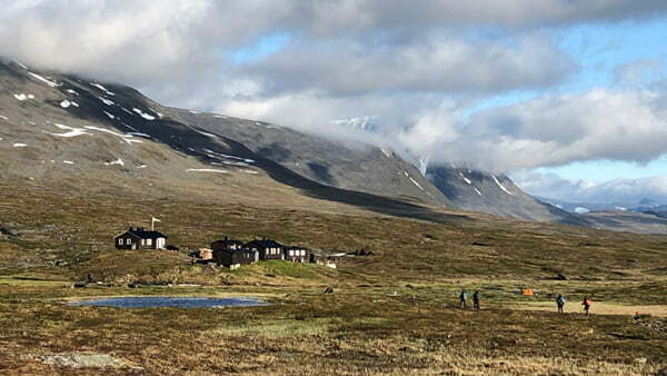
Wonderful sunshine and we started in this day. From now on it went easily, the Kungsleden trail is wide and leaked. For many kilometers we followed the extended valley, along the riverbank through a beautiful heath landscape. Past rest houses, over some pretty impressive rivers. A reindeer herd crossed the river before our eyes. Shortly before the Singi hut there is a branch to the mountain summit Kebnekaise. We did not make the ascent to the summit. We moved on because that would have been a walking time of two days at least. Lunch break at the Singi Fjällstation Behind the Singi hut the Kungsleden led us through slightly hilly terrain along the banks of the Tjäktjajakka. Due to the good weather conditions we had an incredibly beautiful view. Past the remnants of a dilapidated Kote, following the course of the valley, we now reached the tree line and it began the typical Fjäll beech forest. At the station Kaitumjaure with a little store we had a short break and went into the evening sun. The Kungsleden trail impresses with the whitewater course of the Kaitumjakka, which murmurs merrily to itself. After numerous rapids and waterfalls, we went up to the treeless Muorkifjäll plateau. The stony path is lined with swamps and ponds. The terrain became flatter and the view more spacious, a beautiful panorama over the Kaitum valley. On the plateau, hiking was easy and after a very steep descent towards Teusajaure we set up our tent above the mountain station at 10:30pm. A very long hiking day on the King´s trail. This unusual experience midnight sun, kept us going for so long.
5. Teusajaure to Saltoluokta (camping site Saltoluokta) 14km
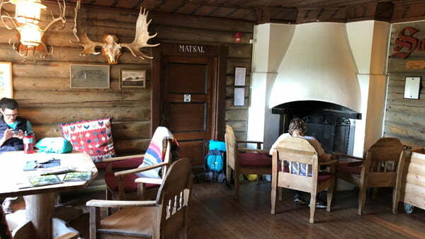
This day started with a boat transfer at 7am. The nice station keeper informed us about the possible and quite usefull membership in the SvenskaTuristföreningen (for couples 450 Swedish kronor annual fee). We payed the membership. The comfortable passage by motorboat lasted only 5 minutes and cost 100 SEK per person. From the jetty on the south bank of the Teusajaures the Kungsleden led uphill, into a dense birch forest. It took us an hour to reach the treeless heath. After 4km we reached a newly built suspension bridge and the route took us over the Sarekfjäll. The Kungsleden led over planks, sometimes past isolated stone blocks and over small bridges over narrow streams. We enjoyed fantastic views of the northern mountains. At the end of this stage we went downhill, through a mountain birch forest and at noon we reached the reservoir Suorvajaure. We stopped at the Vakkotavare hut. This is the first interruption of the Kungsleden. The Kungsleden continued at the north bank of the Suorvajaure. To get to that place you have to ride by bus. Afterwards transfer by ferry MS Langas, which takes about 10 minutes and costs 140 SEK per person. Both in the bus and on the ship, payment is only possible with a credit card. We enjoyed this charming Fjällstation Saltoluokta and pitched our tent on the campsite with service house and sauna. These amenities cost a total of 300 SEK.
6. Saltoluokta to Skierffe (1179m) (campsite on Skierffe) 36km
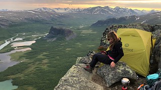
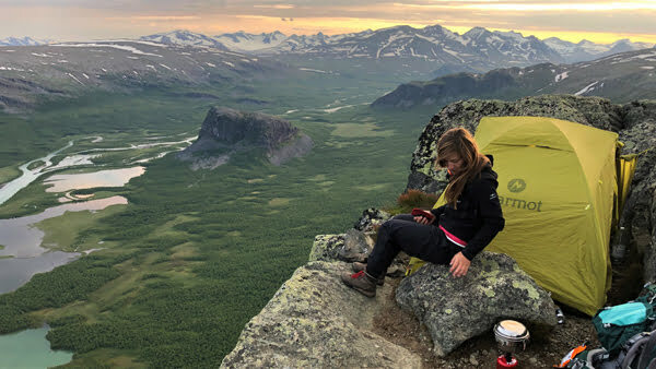
The next morning fully recharged continued the long-distance trail Kungsleden, initially steeply uphill. Accordingly, the vegetation changes from needle to birch forest to blueberry shrub heath. We ran on the ridge parallel to the creek Autsutjjakka. Past some smaller mountain lakes and the 979m high Tjiark is a clear landmark. Through a sparse birch forest we descend to the shore of the Kaskajaure a part of the lake Sitojaure. Arrival time 3:30pm at the mountain lodge. We still had plenty of time for a warm meal in the communal kitchen of this very simple Fijällstation Sitojaure. At 5:00pm back to the Sámi family, who not only organize boat traffic, but also sell food. This 4 km long crossing took about 15 minutes and cost 300 SEK per person. Here only cash payment was possible. Arrived on the southern shore, we are on the Kungsleden again and hiked through birch forest and swampy sections. After about 2km, the slope increased and over block rocks the climb led up to the ridge of Njunje. A beautiful view of the vast water surface of the Tjaktjajaure and in the north overlooking the delta of the Rapadal. About 2km before the Aktsehütte, the Kungsleden trail branched off to the right towards Skierffe (1179m). Actually, this ascent was planned the next morning, but there were so many mosquitoes here, really a real horror, that we hiked the 7km up to the summit the same day. It was just the place, the day’s effort was gone and an unbelievably beautiful experience is remembered. We will never forget the view of this delta. At 10:30pm a mild midsummer night and a spectacular place for our tent with the view of the delta and mountains of Sarek National Park.
7. Skierffe to Schutzhütte Jägge (camping near Jägge hut) 20km
It was hard for us to say goodbye to this special place. We were lucky with the weather and the view of the surrounding mountains of the National Park Sarek. The first hikers on Skierffe arrived around 9:30 am. Be aware in bad weather conditions, this place can´t be recommended for camping. We wanted to continue our hike on the Kungsleden trail and arrived at the Aktse Hütte at 2.30pm. There was enough time for lunch and a chat with fellow travelers. Departure time for the motorboat was at 5:00pm (200 SEK pp.). The crossing on the Laitaure took 15 minutes and was a nature experience. The panoramic view of the Sarek portal, a striking mountain range, is breathtakingly beautiful. Arrived on the other side, we still had 10km to go on the Kungsleden in the afternoon sun. The goal was to avoid the mosquitoes down in the forest near the lake, which are particularly persistent in this region. First, we ran without significant height differences through coniferous forest and birch forest. Then a fairly steep climb up to the treeless plateau. From here you can see the reservoir Tjaktjajaure and the Rittak valleye. There are sea eagles and golden eagles and even brown bears and lynx apear in that area. More or less unlucky we have not seen any of these animals. Towards evening the weather changed and it started to rain. Shortly before the hut Jägge we set up the tent.
8. Jäggehütte to Kvikkjokk (Fjällstation Kvikkjokk) 26km
At 6:30am awakened and at 8am marched off, still mosquito alert. We passed the Jägge rest house, which is located in a small birch grove. Now it went with a gentle slope to a suspension bridge over the mountain stream Jäkkejagasj, who has cut a neat gorge in the slope. There the Kungsleden followed a strong climb over block rocks to a pass between the peaks Huornatj (884m) and Faunaive (1117m). A beautiful high mountain area bordered on the horizon by snow capped peaks. The Kungsleden trail now loses altitude quickly and we ran into a valley filled with birch forest. An unspoiled woodland with many berry bushes, fallen trees and mossy rocks. In the further course we arrived at noon to the Parte hut, which was idyllically built on a promontory in the lake Sjabtjakjaure in 1965. On our arrival a helicopter had rescured injured hikers. The house guard Gunnar told us that a flight cost apr. 3000 SEK. After the hut the Kungsleden trail made his way through forest and moors, past reindeer enclosures. Shortly before reaching the Stuor-Tata lake, a storm came clother, making the section directly on the shore very slippery. The panorama, however, was impressive. The lake nestles among wooded hills bordered by a mountain range in the distance and the water surface is livened up by numerous islands. Now it was 6km to the well-deserved destination Kvikkjokk. The route seemed to have no end Because after the rain the mosquitoes were there again, terribly annoying. Fortunately, we were able to get a double room in the Fjällstation Kvikkjokk, after all 900 SEK incl. Showers, sauna and drying room. To our hiking companions we said goodbye, because many left here the Kungsleden. One of the few possibilities for public transport.
9. Kvikkjokk to Tsielekjakk hut (camping beside the path) 15km
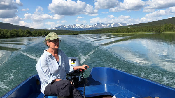
A rich breakfast buffet (100 SEK per person) and the nice stay in this Fjällstation let us spend some time there. At 2pm was the boat transport, before we had a look at the wooden church in Kvikkjokk. The transfer via the Sakkat takes about 20 minutes, also here there are fixed departure times and only cash payment is possible. The Kungsleden continued on the lake shore in a towering coniferous forest well uphill past firs and pines. At the top we crossed a small waterfall and there Claudia then actually slipped while collecting water and fell in with a backpack. About 4km after the start, it temporarily became a bit shallower and our gaze swept over a vast marshland, which was bordered by impressive peaks behind the forest fringe. The entire route was very pleasant to walk because of fewer stones on the way and we hardly met any hikers. Finally we reached a high plateau with grassy areas, single birches and small lakes. After a total of 12km hike of the Kungsleden we set up our tent at the riverbank on the imposing suspension bridge at around 6pm. An almost perfect place for this night, right on the banks of Tsielekjakk. Opposite was the Tsielekjakk hut, this refuge is unsuitable for sleeping.
10. Tsielekjakk hut to Tjäurakatan (camping beside the trail) 30km
Day ten of our hike on the Kungsleden. After 9km, the path led over a ridge with a wide view to the south, past the towering Goabddabakte (1266m), a black towering rock face. Now it was just downhill and we had to be careful to catch the right path, you can get lost here and then ends up mistakenly in the Samí village Parka. On the right of the path, the river Falesjahaka was rushing in a deep canyon. On numerous boardwalks we walked over a mosaic of bogs and small rocky outcrops and reached in the afternoon the suspension bridge Piteälven. Passed small islands and rushing rapids between the two lakes Falesjavrre and Tjieggelvas. Soon the Kungsleden trail ran through uneven terrain, here were not everywhere planks and it was pretty muddy. During the ascent to the Kahlfijäll we had a nice view, unfortunately the sky was closing and it blew a decent wind. As time went on, it flattened again and we walked on a stony path, through a barren landscape with rugged blocks of stone and ankle-high bushes. The rain began and it stormed, near a little stream behind a rock we set up our tent.
11. Tjäurakatan to Vuonatjviken (Shared room/Guesthouse) 22km
It was raining all night and still in the morning. Anyhow we started at 11am. A short time later, we passed the old restored reindeer shelter Tjäurakatan on the Kunsgleden, the interior was unfortunately very dirty. In increasingly bad weather, we ran through the fog on the plateau of Jakkakaskajarro. After the highest point in this section, you follow the Kungsleden straight to the south. No recognition of Juoksakjakka, the survey Baraktjahkka and the Gabdak lake system.
Shortly after the bridge, over the mountain river Vilit-Jakka, we passed unnoticed the Arctic Circle. No sign on the Kungsleden. Rugged, rather difficult terrain with slippery rocks crossed a dense mosaic of ridges, bogs, lakes and rivers, connected by planks and bridges. From the suspension bridge of the river Bartek, it was still 5km to the shore of the lake Riebnes. The houses of Vuonatjviken have not been seen yet. Completely soaked and hungry, we found ourselves soon in one of the buildings. Later on we had a social evening with Heide from Heidelberg and Stuart from Canada. A hot shower and the drying room, let us quickly forget the hardships of the day. The overnight stay cost 400 SEK per person and the boat transport the next morning was 350 SEK per card.
12. Vuonatjviken to Jakkvikk (Room in Kyrkans Fjällgard) 23km
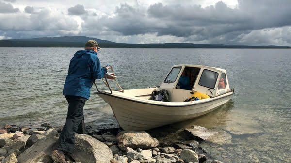
Our last hiking day on the Kungsleden! The lake crossing started at 10am and was about 7km long. A nice easy walk led through a fairytale forest, past the wooden houses in Saudal and unfortunately also some high voltage lines. After 18km we reached the shore of the Hornavans and the heavy roaring of the rapids of the lake Harrselet could be heard everywhere. Now we had to row for the first time, a distance of about 300m. In total, there are 4 boats, it is always important to ensure that one rowing boat for subsequent hikers on each bank remains. Our hike stopped at the eastern shore of the lake Jäggavvre. Following a spontaneous inspiration, we have decided to jump into the ice-cold water. What an experience! We reached the very cozy and affordable accommodation Kyrkans Fjällgard (also camping is possible) at 4:30 pm. You have to pay in cash, no card payment.
Personal Statement
The countless kilometers of beautiful memories, all that we have seen and experienced, we have written down and celebrated. We could not have had a better time on the Kungsleden or King’s trail in Sweden.
Conclusion
- The Kungsleden trail does not contain any technically demanding passages. The biggest challenge is the changeable weather. All in all, endurance is the key to this tour.
- The website www.resrobot.se provides good planning services, while train tickets can be conveniently booked online at www.sj.se. You need some time for traveling in Sweden, because often there are only a few transport connections per day.
- Cash is not always accepted, you need a credit card. Bus connections via www.lapplandspilen.se, timetables at www.ltr.se.
- The assortment of food in the mountain stations is comprehensive, but a bit more expensive. It is advisable to bring a tent, because the right of public access applies in Sweden . For one night you can build your tent in nature and stay anywhere. Most of the relevant Kungsleden huts are run by the STF, so a membership in Svenska Turist Föreningen is recommended. The annual fee for families/couples is 450 SEK and includes discounts for accommodation and boat transfer.
- Mosquitoes can be a nightmare in summer. We experienced this only in specific ereas like Aktse or the forest around Kvikkjokk.
- The Kungsleden is marked in most sections. Sometimes a simple map is usefull. Don´t spend money for expensive maps.
- Electricity can be a challange. It´s a good advice to bring your powerbank, solarpanel. We use the Base9 Solar.

Stefan & Claudia
For more information about HikingExperience do not hesitate to contact us.


